Ring of Fire! Part One: Dayville to Ochoco Pass
 The TransAmerican challenge has come to a grinding halt and for the first time the chances of reaching the Pacific are in real jeopardy. We're stuck halfway up the Ochoco Pass, fifteen miles out of Mitchell in Oregon and the mountain ahead is cloaked in smoke. In the valley to our left a helicopter trails a huge scoop into a lake and heads towards the fire in an attempt to douse the flames.
 In the skies above the most intense plumes, a giant four-engined aircraft tries to smother the blaze with a cloud of fireretardent powder. Riddled with 6,000 lightning strikes, Oregon is ablaze and this one is sitting right in our way. Our only option is to wait it out, or take a hundred and sixty mile diversion, which could take two days.
  The day had started so well. We awoke in Dayville Presbyterian Church at 4am, enjoyed a pancake and egg breakfast expertly cooked by Mike and were on the road a little after five thirty. A few miles down the road and we were cycling through yet another astonishing geological landscape. Picture Gorge, made up of seventeen layers of basalt was formed from lava floods sixteen million years ago. Over time fault lines in the rock were eroded by the river, cutting a gorge more than a thousand feet thick. It made for an exhilarating ride, each twist and turn revealing something new.
 We should have guessed the day was about to go pear-shaped when we met up with Daniel, Derek and Jesiah who were five days into their eastbound trip. Derek, sporting a huge American flag on the back of his bike, was topping off each day by climbing the nearest mountain. As Terry remarked: "young and foolish!" At the end of the conversation they just happened to let slip that the road west from Mitchell (the next town on our route) was closed due to a forest fire. Really????
 It seems the TransAm is determined not to give us an easy finish. We'd already climbed 2,000 feet in 28 miles to reach the top of the Keyes Creek Pass and got up early so we could also tackle the higher and steeper Ochoco Pass before the stifling afternoon sun took hold. Now our plans were in tatters.We arrived in Mitchell (population 130) to find a town in confusion. The road was opening in two hours, we were told. Next minute we were told it would remain shut until tomorrow. Meanwhile the Red Cross had set up an Evacuation Centre at the local school. Finding any clear and accurate information was proving impossible, so as in any crisis, we decided the best thing to do was to eat lunch.
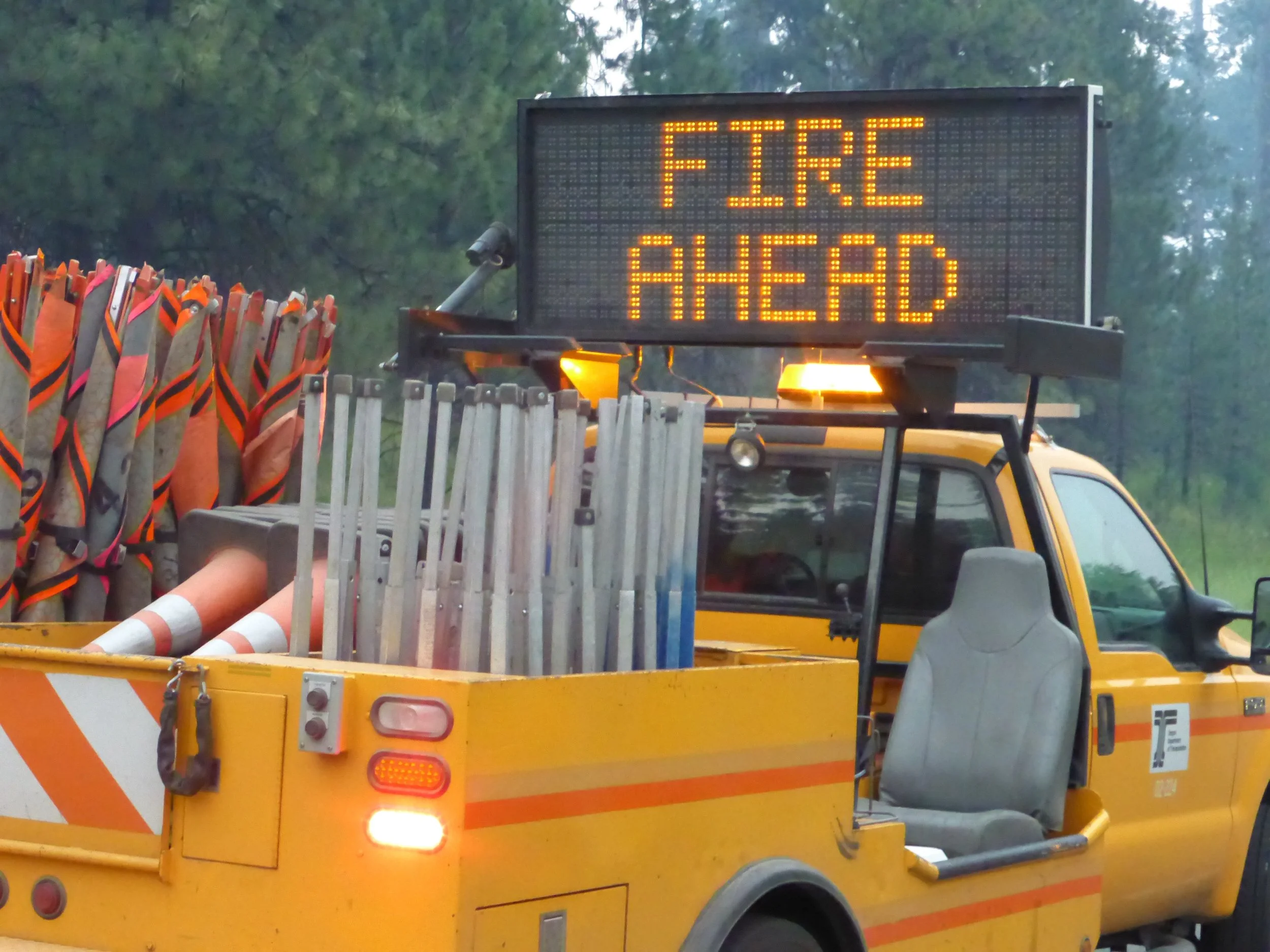
 We were able to establish that Jerry and Jonathan had left their hotel in Mitchell very early that morning and from accounts by passing motorists learnt they had spent the day sitting at the roadblock up the pass, hoping to be let through. Two weary firefighters arriving in town gave us hope the pass might be open in an hour or so, so we bought extra Gatorade for Jerry and Jonathan and started our second ascent of the day. As we climbed we smelt smoke and soon we could see huge white and grey plumes rising from the ridges ahead.
 We found Jerry and Jonathan sitting on the road closed sign where they had been since 7am. Nothing was moving - except Mike who decided to take the offer of a truck ride over the pass. For Jonathan, Jerry, Terry and myself, the thought of taking a lift at this stage seemed too soon.Except for crossing the Chesapeake River on a bus, because bikes were not allowed on the tunnel and bridge, we've ridden 4018 miles - and we didn't want to take the truck option without at least giving the fire a chance to burn out. So we are waiting it out, camped down in a giant gravel shed which we are sharing with some nesting Martins.
 So, for now, with only 250 miles to go, fire stops play.Miles today: 48 milesMiles since First Landing: 4018